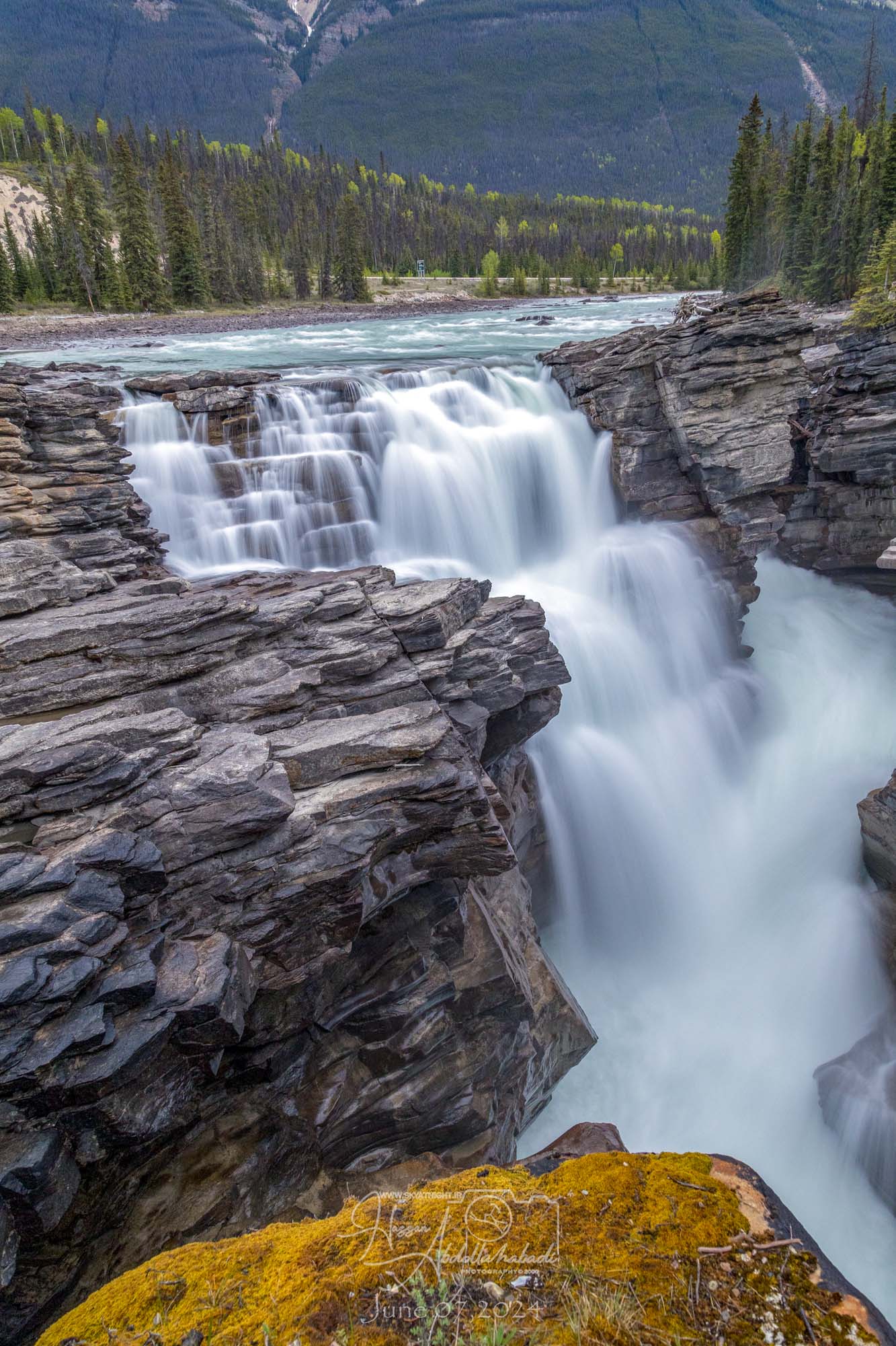
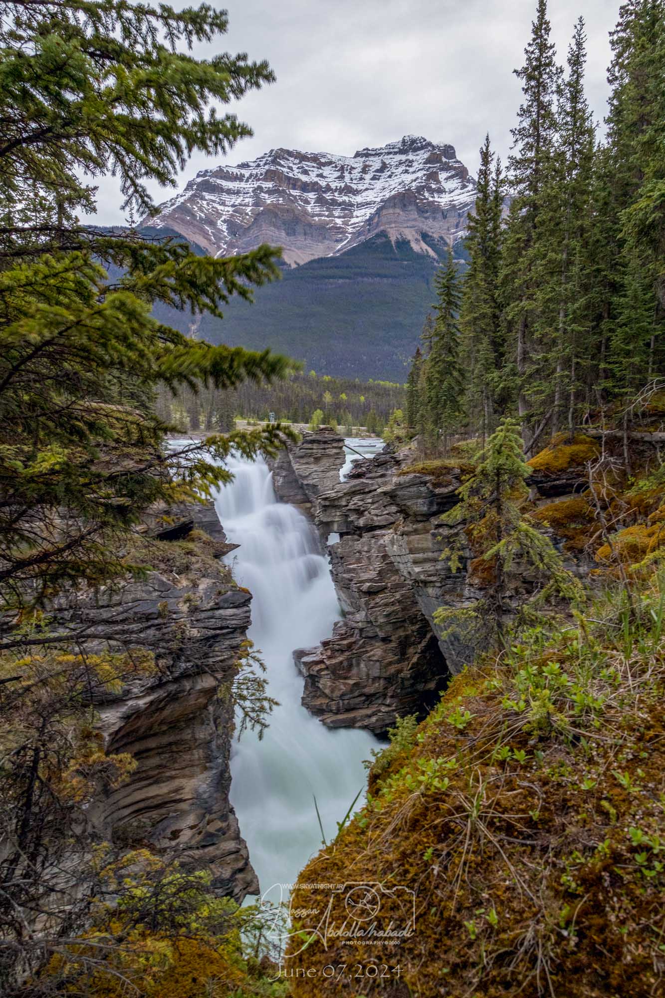
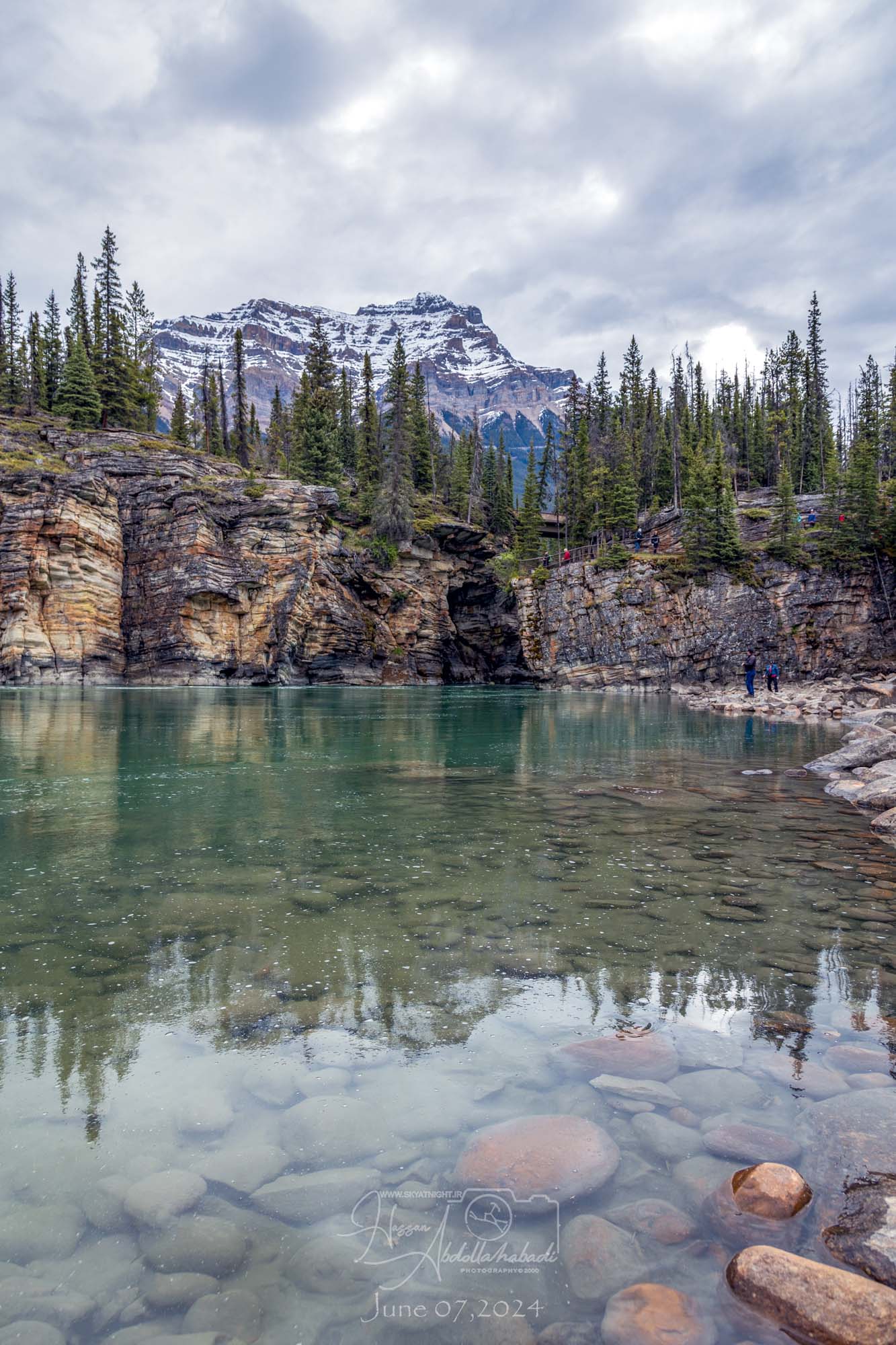
Athabasca Falls
Athabasca Falls is a waterfall in Jasper National Park on the upper Athabasca River, approximately 30 kilometres (19 mi) south of the townsite of Jasper, Alberta, Canada, and just west of the Icefields Parkway.
Athabasca Falls is one of the most famous and frequently visited waterfalls in the Canadian Rockies due to it’s breathtaking beauty and easy accessibility.
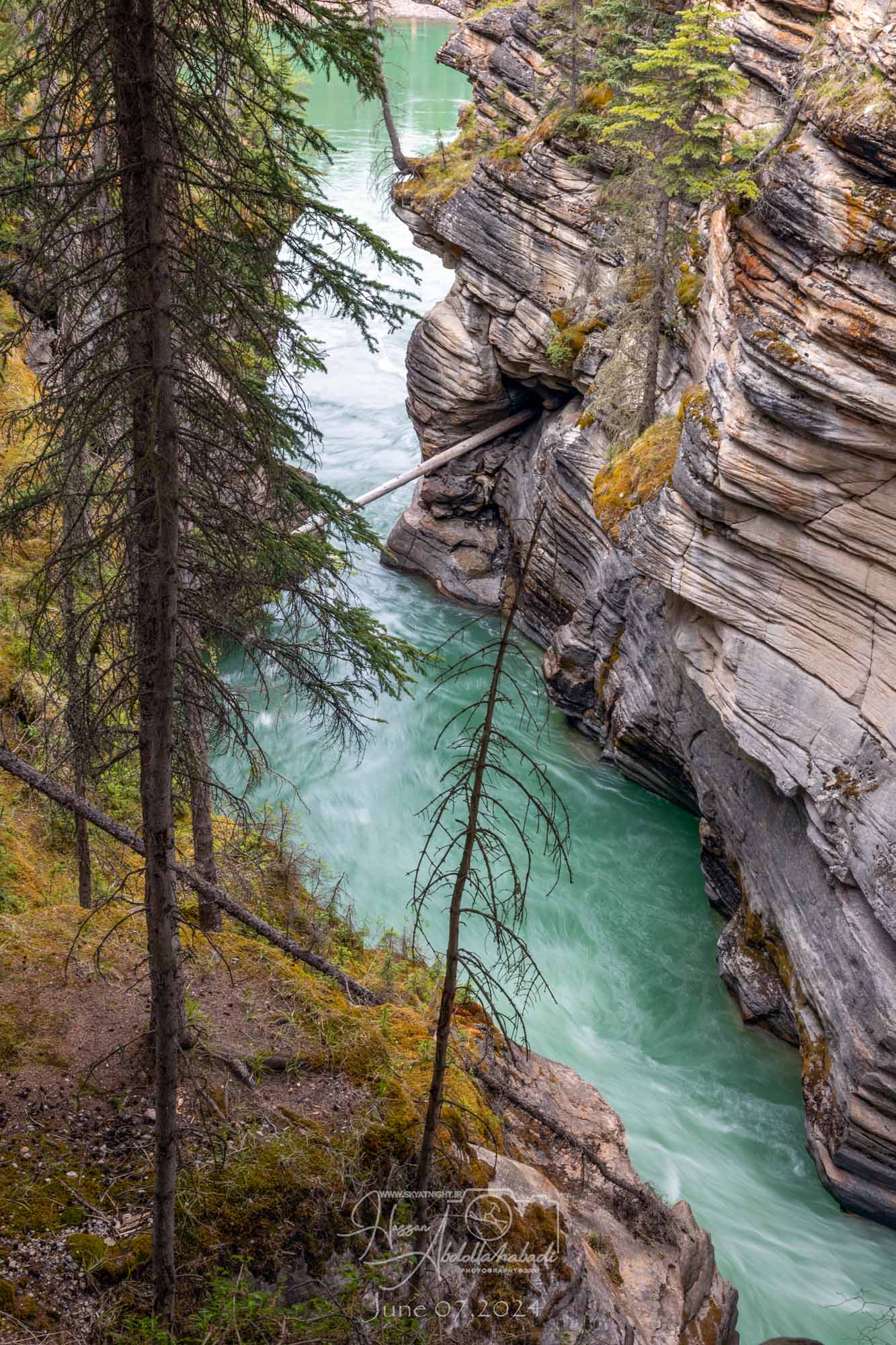
Athabasca Falls are known for their strength due to the large quantity of water. Even when Athabasca river levels are at their lowest in the autumn, large amounts of water still flow over the falls.
The Athabasca river falls over hard quartzite and through softer limestone, carving the shorter gorge and a number of potholes. Athabasca falls can be safely viewed and photographed from numerous platforms and hiking trails around the falls.
Access is from the nearby parking lot, which leads off Highway 93A just northeast of the falls. Highway 93A takes off from the nearby Icefields Parkway, and crosses the falls on the way north to the town of Jasper.
Whitewater rafting often starts below the falls to travel downstream on the Athabasca River to Jasper.
The Athabasca Falls Hike..
Designated trails allow you to feel the spray of the Athabasca River as these falls thunder into the canyon 24 meters below
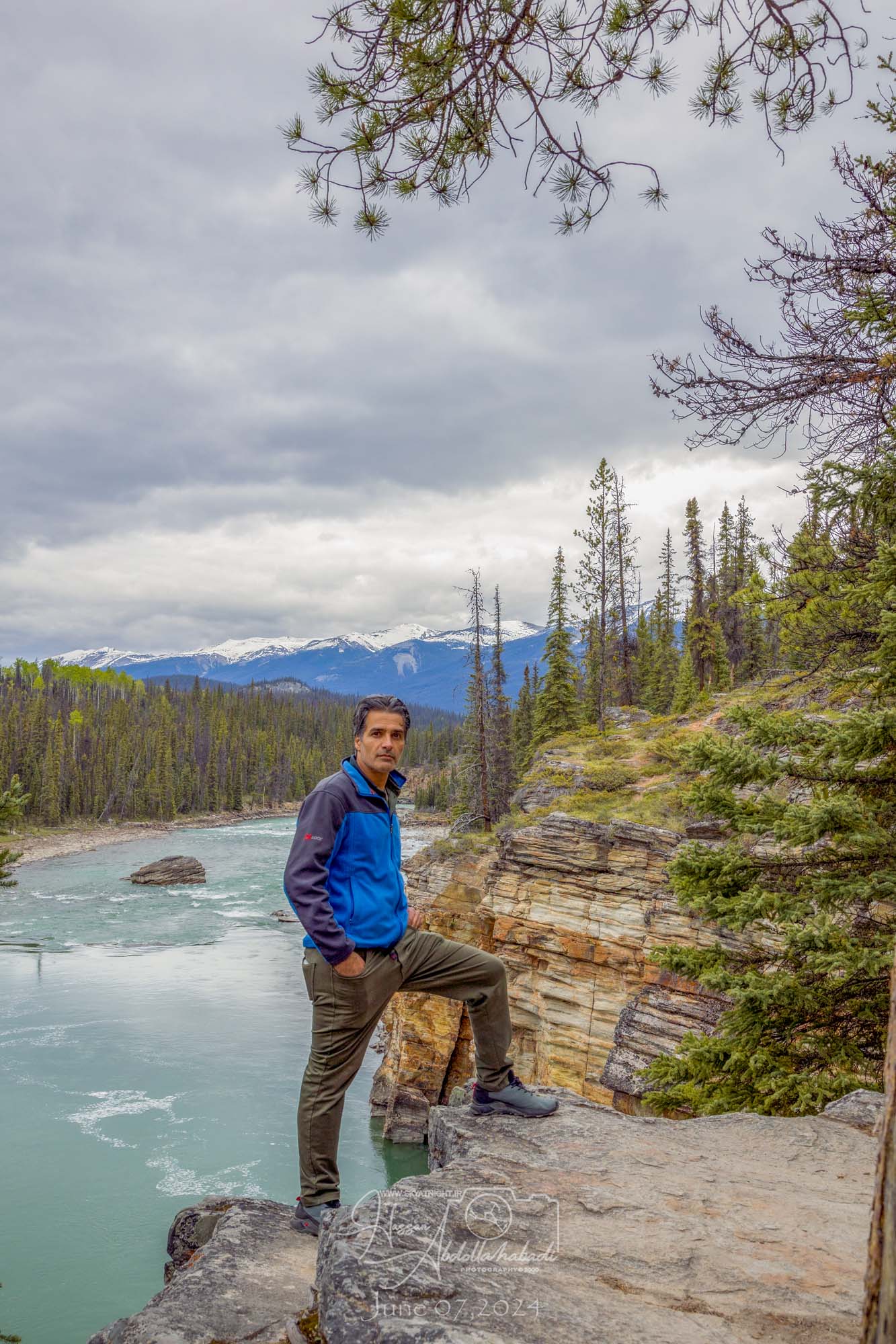
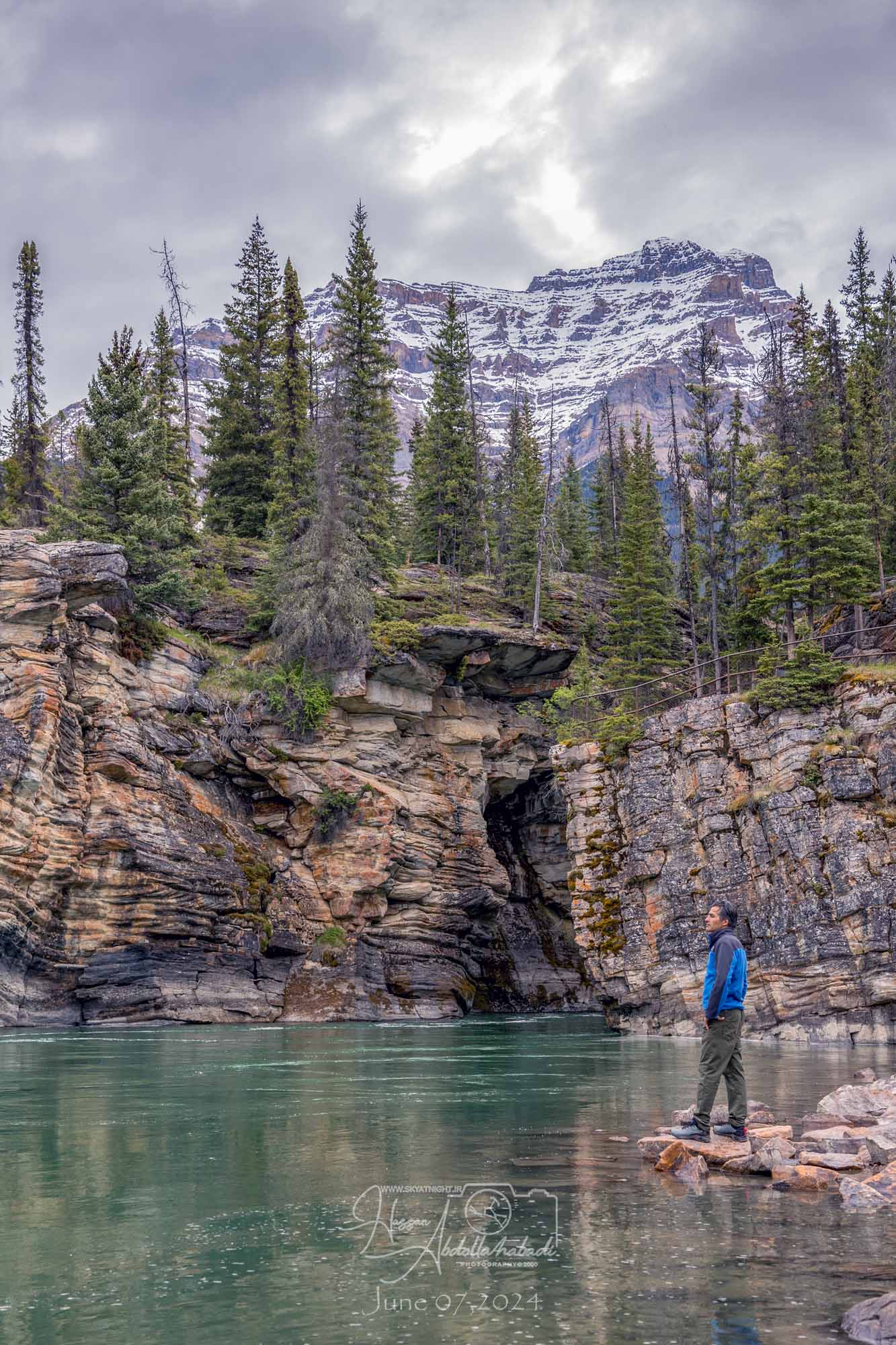
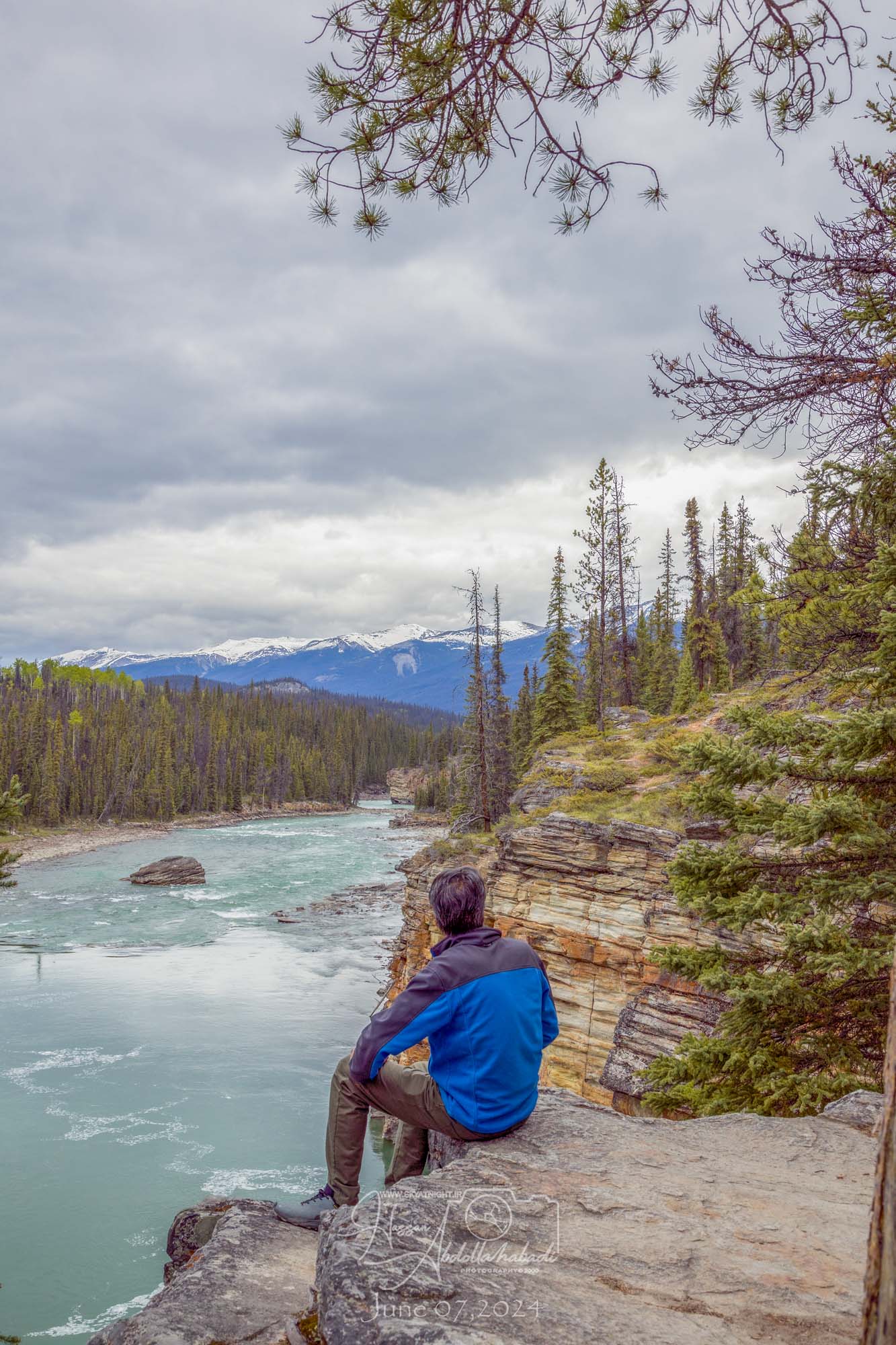
Flowing from the glaciers of the Columbia Icefield, the Athabasca River is the largest river system in Jasper.
In 1810, David Thompson, Canada’s premier map-maker and explorer, plied the Athabasca in search of a viable fur trade route to the Pacific Ocean. Discovering Athabasca Pass in early January 1811, David Thompson’s route helped establish Canada as a country that spans the North American continent.
آبشار آتاباسکا
آبشار آتاباسکا آبشاری در پارک ملی جاسپر در بالای رودخانه آتاباسکا، تقریباً ۳۰ کیلومتر در جنوب شهر جاسپر، آلبرتا، کانادا و درست در غرب پارک وی آیسفیلدز است
آبشار آتاباسکا به دلیل زیبایی نفسگیر و دسترسی آسان، یکی از مشهورترین و پربازدیدترین آبشارهای رشتهکوههای راکی کانادا است
آبشار آتاباسکا به دلیل حجم زیاد آب، به دلیل قدرتش شناخته میشود. حتی زمانی که سطح آب رودخانه آتاباسکا در پاییز در پایینترین حد خود است، همچنان مقدار زیادی آب از روی آبشار جاری است
رودخانه آتاباسکا از روی کوارتزیت سخت و از میان سنگ آهک نرمتر سرازیر میشود و تنگه کوتاهتر و تعدادی گودال را ایجاد میکند. آبشارهای آتاباسکا را میتوان با خیال راحت از سکوها و مسیرهای پیادهروی متعدد در اطراف آبشار مشاهده و از آنها عکس گرفت
دسترسی از پارکینگ مجاور است که به بزرگراه ۹۳ درست در شمال شرقی آبشار منتهی میشود. بزرگراه ۹۳ از پارک وی آیسفیلدز در همان نزدیکی حرکت میکند و در مسیر شمال به شهر جاسپر از آبشارها عبور میکند
قایقرانی در آبهای خروشان اغلب از زیر آبشارها شروع میشود تا در پایین دست رودخانه آتاباسکا به جاسپر برسد
پیادهروی در آبشارهای آتاباسکا
مسیرهای تعیینشده به شما این امکان را میدهند که اسپری رودخانه آتاباسکا را احساس کنید، زیرا این آبشارها با سرعت به دره ۲۴ متری پایینتر میریزند
رودخانه آتاباسکا که از یخچالهای طبیعی میدان یخی کلمبیا سرچشمه میگیرد، بزرگترین سیستم رودخانهای در جاسپر است
در سال ۱۸۱۰، دیوید تامپسون، نقشهبردار و کاوشگر برتر کانادا، در جستجوی یک مسیر مناسب برای تجارت خز به اقیانوس آرام، از آتاباسکا عبور کرد. کشف گذرگاه آتاباسکا در اوایل ژانویه ۱۸۱۱، مسیر دیوید تامپسون به تثبیت کانادا به عنوان کشوری که قاره آمریکای شمالی را در بر میگیرد، کمک کرد